
Walk a Palm Bay Street
Begin with the Brevard Property Appraiser search. Range mode builds an owner-oriented view of a road segment from the required From, To, and street Name fields. Direction, type, suffix, city, and ZIP are optional. This is the best first move in a Palm Bay street directory because it keeps similar road names and quadrant suffixes apart.
- Enter a street range. Open each parcel card and record the situs, owner, mailing address, account number, parcel ID, and legal description.
- Open MapView. Click the subject polygon and adjacent parcels, then use Details to compare both sides of the block.
- Pass the parcel ID or legal description into the Brevard Clerk deed index. Confirm the current acquisition and named parties.
- Use voter information only through lawful official channels. Treat registration as dated evidence, never a household roll.
- For an older address, consult Hill-Donnelly criss-cross books by address or phone at the Central Library in Cocoa.
The flow is address to parcel, parcel to owner, owner to deed, then dated resident evidence. No one step proves who sleeps at the property.
Palm Bay Property Search Fields
The BCPAO portal searches much more than one house number. Its parcel fields keep the street directory tied to recorded land when postal wording changes.
| Field | Input | Street Use |
|---|---|---|
| Site Address Range | From, To, Name; optional direction, type, suffix, city, ZIP | Build a road segment |
| Owner Name | Keywords in any position | Check a named owner |
| Parcel ID | Full or partial land code | Anchor exact land |
| Subdivision or plat | Name, block, lot, book/page | Group planned areas |
| Characteristics | ZIP, year, acres, use and value | Narrow results |
A parcel card may show owners, mailing and situs addresses, legal description, subdivision, block and lot, values, exemptions, sales, improvements, sketches, photos, and maps. A mailing address is where tax notices go. It does not prove occupancy.
Open the official MapView source shown below.
The county viewer connects mapped polygons with parcel Details, the key link between a visible block and its assessed records.
Map Palm Bay Parcels
MapView adds the shape of the block. Layers include aerial imagery, water, township and range, sections, subdivisions, blocks, parcels, condominiums, and labels. Close zoom can display dimensions. Quick Search, Measure Tools, Make a Map, sales-year choices, and photo or information views help test whether two formatted addresses refer to the same land.
Click each adjoining polygon one at a time. The public viewer has no verified bulk radius owner export. This makes street-by-street work slower, but keeps each name beside a distinct parcel and date. Palm Bay PM Units and other subdivisions may be steadier keys than informal neighborhood names.
- Parcel
- A legally described unit of land tracked by the appraiser.
- Situs address
- The physical address assigned to assessed property.
- Plat
- A recorded map dividing land into lots, blocks, roads, or tracts.
- Criss-cross directory
- A book arranged by address or phone rather than name.
Note: Palm Bay postal wording, city limits, ZIP, quadrant, and subdivision describe different geographies and should not be treated as interchangeable.
Address Records Across Palm Bay
Several custodians contribute to a Palm Bay street directory. Match each source to the fact it can support.
| Source | Keeper | Evidence | Access |
|---|---|---|---|
| Assessment roll | Brevard Property Appraiser | Owner, situs, mailing, legal parcel, exemptions, structures | Web, phone 321-264-6700, data request |
| Parcel map | Property Appraiser | Adjacency, lots, blocks, aerials, subdivisions | Free MapView |
| Official Records | Brevard Clerk | Deeds, liens, mortgages, plats, parties | Web from 1981; branch earlier |
| Permits | Palm Bay | Work, contractor, inspection, address context | GIS, office, phone, Chapter 119 request |
| Voter file | Supervisor of Elections | Public registration address and districts | Lookup or regulated data request |
County counters, mail, phone, and written requests matter when a portal fails. Clerk Recording can be reached at 321-637-2004 or PO Box 2767, Titusville, FL 32781-2767. Public web images allowed by law are free. Only branch copies are authoritative.
Follow Palm Bay Deeds
The Brevard Official Records index links a parcel to grantors and grantees. Modes include name, book/page, instrument number, document type, date, case number, legal description, and parcel ID. For a whole street, the stable parcel or legal description is safer than a typed address.
Online coverage starts January 1, 1981. Earlier work moves to Clerk branch deed books and historical grantor-grantee indexes. Search spelling variants. A hidden web image may be legally restricted, and does not mean the indexed filing vanished. RCRC and branch counters provide research, plain copies, and certified copies. Recording Notification Service can watch a name or legal description, though an alert does not validate a filing.
Palm Bay Permit Evidence
City permits can date work at an address, but are not a resident list. Palm Bay Building Permit GIS exposes Building Permits and Building Inspection Data. Permit status may distinguish a new structure, addition, or repair from a change in ownership. Work submitted through iMS begins March 6, 2023; the full digitized archive start was not verified.
The official permit GIS service is captured below.
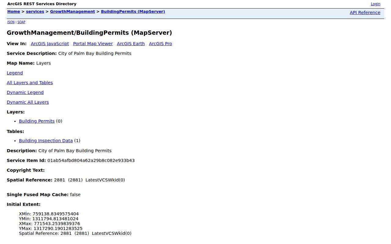
The mapped layer identifies permit context, while the city office or a focused public-records request supplies detail not shown on the map.
Palm Bay Quadrants and ZIPs
A quadrant suffix is not a ZIP boundary. Official places within 32907 use both NE and SW suffixes, so dropping the direction can send a street directory search to the wrong road. USPS wording also does not prove a parcel lies inside incorporated Palm Bay.
Brevard Address Assignment is the authority for new or corrected addresses at 321-690-6846. Its E911 guide tracks low and high ranges, odd and even sides, community, and emergency service number. Palm Bay road-renaming applications require an abutter mailing list and E911 coordination. Those files can preserve owner evidence when a road name changes, but the research confirms no blanket renumbering year.
Old Palm Bay Street Entries
Hill-Donnelly volumes at Catherine Schweinsberg Rood Central Library cover 1969 through 2006 with gaps. They reverse the usual method: search by address or telephone, explicitly not by name. That makes them useful after parcel and deed work establishes an old address. The Palm Bay city directory collections explains the whole shelf; this street directory uses it only as address evidence.
Search Tillman before Palm Bay for early records. Roughly 200 residents petitioned for the Palm Bay name in 1925. For material before Brevard's creation in 1855, try catalogs under former St. Lucie County territory. These name and jurisdiction shifts can matter more than modern spelling.
Palm Bay Voter Street Data
Florida voter data can contain a public residence address, party, phone, email, precinct, and participation history. It never reveals ballot choices. Protected addresses, ID numbers, registration source, signatures for copying, and preregistrant data are restricted.
Brevard's file has 47 fields, uses Palm Bay City Code 10, and includes address components, district fields, precinct, status, and up to 20 election-history columns. Channels include the county data form, the Viera office, the Palm Bay branch at 450 Cogan Drive SE, 321-290-8683, and elections@votebrevard.gov. The state self-lookup requires a matching name and birth date and is not a browseable street roll.
Palm Bay Street Directory Limits
A property roll is an ownership index, not a census. It can omit nonowners, children, unrecorded household members, recent movers, and protected people. Vacant parcels may lack a situs address. Homestead supports an owner-occupancy inference for an assessment period, but cannot name a household.
Driver data is restricted under federal and Florida law. Public agencies need not create a new list merely because one is requested. Commercial compilations may merge names or repeat stale addresses, so verify each item with its named custodian.
Lawful use. Use Palm Bay street records for respectful personal research, property history, and civic curiosity. Never use them to stalk, harass, intimidate, or harm anyone.
Keep a source and inspection date beside each result. A deed, tax mailing address, voter registration, and old directory entry may all be accurate while describing different roles and times.
Verify Palm Bay Street Results
Dates control the meaning of an address record. The appraiser is strongest for its current owner display, a deed proves a recorded transfer on its instrument date, and a permit dates work at the property. Voter data reflects registration at an update point. Old evidence should never become a claim about the present.
Preserve the indexed name, parcel or instrument number, role, address type, and inspection date. Try initials, hyphen variants, former surnames, partial streets, and the stable legal description before recording a negative result. A later record does not always correct an earlier one because the two may describe different roles.
A trust, estate, company, or remote owner can hold land. An address in a business or court filing may belong to an agent, office, or lawyer. A careful Palm Bay street directory result says assessed owner, deed grantee, registered voter, or listed directory occupant instead of collapsing them into one label. That distinction makes street-by-street research far more reliable.